Stillaguamish Tribe
Arlington, WA
Cultural Resource Server and Training Initiative
Our Phase 1 grant allowed us to develop core cultural resources services for a move into a new collections facility in our Tribe’s newly constructed Administration Building. Our goals were to better understand curation facility needs, including software and hardware, as well as to identify sources of support and funding for the new facility.
Our grant made it possible for us attend the Association of Tribal Archives, Libraries, and Museums (ATALM) Conference. Our staff returned from the conference more knowledgeable about tools, procedures, and contacts for proper office set-up, as well as ideas for additional funding sources. We learned about archival software (although we ultimately decided to go with Past Perfect), NEH and Smithsonian grants, and curation and preservation tools. With Phase 1 funds, we were able to purchase the software, hardware, and materials, including hosted GIS services for cultural resources consultation that we needed for the new facility.
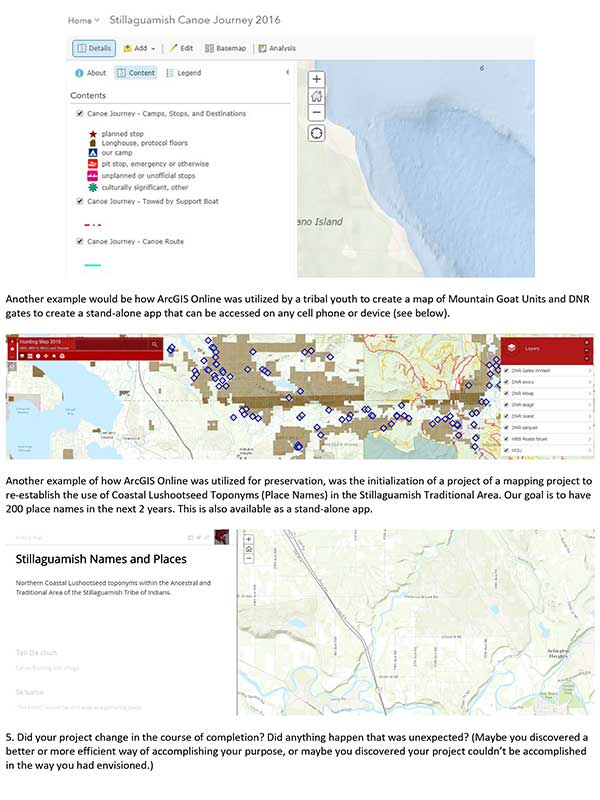
Our new GIS software has proven integral to a variety of tribal projects. Our new Collector app can be utilized on Canoe Journey and turned into a Story Map. Collector also turns your smartphone into a GPS device, and pairs with ESRI cloud GIS (ArcGIS Online). Several staff (and members of Canoe Family) were trained in how to install and utilize the app with their ArcGIS Online accounts. Different templates from the ESRI library can be chosen to make story maps utilizing the data and pictures/videos collected on Canoe Journey. We were able to train Tribal youth, Tribal members, and cultural resource staff in cloud-based GIS and how it relates to Cultural Resources. One of the Tribal youth we trained used ArcGIS Online to make a map of Mountain Goat Units and Department of Natural Resources gates to create a stand-alone app that can be accessed on any cell phone or device. ArcGIS Online was utilized for a preservation mapping project to re-establish the use of Coastal Lushootseed Toponyms (place names) in the Stillaguamish traditional area.
In the course of our project, we came to realize that setting up an archival/curation facility is a massive task that requires additional staff, as well as facilities and materials. We have a long way to go, but also have passion, the advantage of excellent location (in many ways), and rich tradition and heritage. We discovered that we already had several things we thought we needed (Past Perfect Software and a server). We also discovered something we didn’t have (Homestead maps and data) that would have cost much more in staff time than the $500 we spent to purchase it. We made new contacts with neighboring Swinomish and Tulalip Tribes curation staff.
The initial planning support that came from the Phase I grant for the curation facility was invaluable. Our next step will be to continue to work with various departments on implementation of Arc GIS Online, and to develop new apps. We are very excited about the native Lushootseed app for place names, and have a goal of registering 200 toponyms in the next 2 years.
CRF FAQ
CRF PDFs
Contact
Cultural Resource Fund
Peggy Mainor
Executive Director,
The MICA Group
Phone: 505-415-0787


